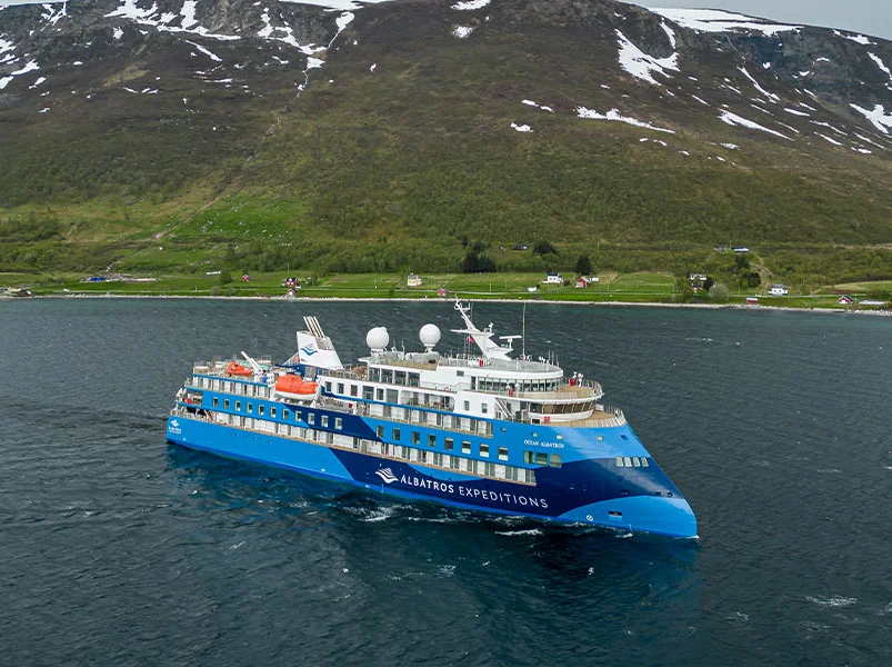
14 Day Artic Itinerary
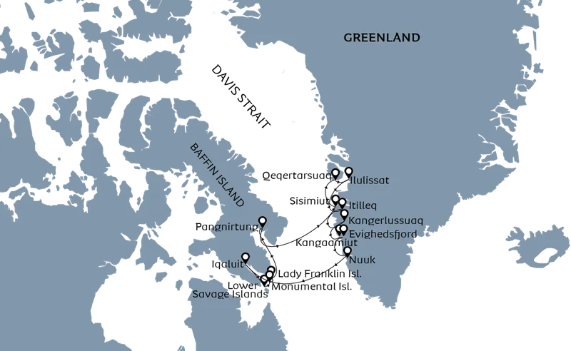
Day 1: Fly Copenhagen/Reykjavik to Kangerlussuaq, Embarkation
We board our charter flight from Copenhagen, Denmark or Reykjavik in Iceland on the first day to Kangerlussuaq, Greenland.
After arriving in Kangerlussuaq, we'll be taken to a small port west of the Airport where the expedition ship is anchored. After check-in, Zodiacs take us to the boat where you will find your room. Enjoy a delicious meal with breathtaking views after the safety drill. We will be sailing through 160 kilometers of the Kangerlussuaq Fjord.
Day 2: Nuuk, Greenland
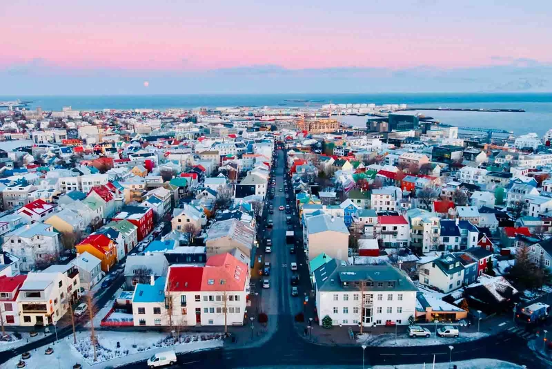
Nuuk, a city full of contrasts, is home to both skyscrapers, and wooden traditional houses. It's a mix of the old and new, the charming and the modern. Nuuk is the vibrant capital city of Greenland. It feels larger than its 19,000 residents and has a variety of activities to offer visitors. Ancient hunters tracked migrating game in the calm fjords surrounding Nuuk. Archaeological evidence indicates that this area has been settled by Paleo Inuit cultures at least since 2200BCE. In the early 100s CE, Icelandic Norse colonists established the Western Settlement on the lush meadows in Nuuk Fjord. These settlers disappeared mysteriously several centuries later. The next Scandinavian who visited the area was Hans Egede. He is the Danish missionary that'rediscovered Greenland' and founded Nuuk in 1728 as Godthab (Good Hope). Danish efforts to modernise Greenland during the 1950s had a profound impact on Nuuk. The city infrastructure was significantly improved, but the large apartment buildings in Nuuk are evidence of rapid urbanisation.
Nuuk is a city that offers so much to visitors. It's the largest in Greenland and has some of Greenland’s most popular attractions. The Greenlandic National Museum in Kolonihavn is a treasure chest of history dating back to Greenland's first inhabitants. It contains artefacts of the Paleo Inuit and Norse eras, along with the fascinating Qilakistoq Mummies. Visit the architectural wonder that is Katuaq to learn about Greenlandic culture. Shop for Greenlandic art in one of the many shops in the district. Or, relax in a trendy curbside café with a Greenlandic cup of coffee while watching the vibrant activity in this city. Nuuk York, as the locals are proud to call it, is unlike any city in Greenland or anywhere else on earth.
Day 3: Kangaamiut and Evighedsfjorden, Greenland
On the first day, we will arrive at Kangaamiut. Kangaamiut, a tiny settlement in central Qeqqata, is located on the coast of Greenland. It is home to a variety of wildlife, cold water, and a rich, untouched backcountry. Locals are a traditional people who live a life based on fishing and hunting. The small museum in Kangaamiut displays some of the most stunning work.
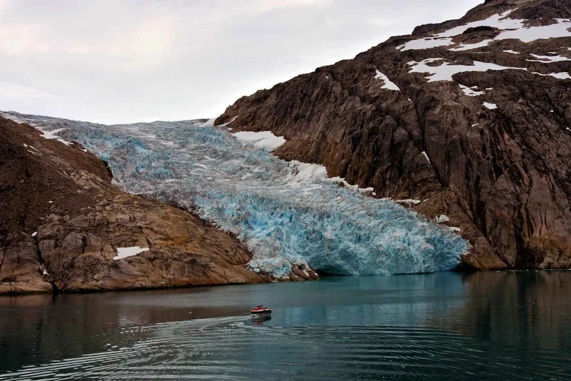
In the afternoon, we will sail inland into Evighedsfjorden/Kangerlussuatsiaq, one of the many deep fjords carved between the steep mountains of this region. The Danish name translates to 'The Eternity Fjord,' referring the the immense size of the inlet. The Greenlandic name 'Kangerlussuatsiaq' translates to 'The Rather Large Fjord', which is a little misleading. Evighedsfjorden, a 100km-long fjord cuts through mountains that are covered with glaciers. The fjord bisects Greenland’s massive ice cap between Nuuk, Greenland’s capital, and Sisimiut.
Day 4: Day at Sea, Crossing the Davis Strait Westbound
The Davis Strait separates southwestern Greenland and eastern Nunavut. It was named after John Davis, an explorer who travelled to this area in search of a Northwest Passage. Formerly, the region was popular with European whalers who came there to hunt the large number of northern right whales that used to frequent the area. Nuuk and Iqaluit are the two largest settlements along the coasts of Davis Strait. The extreme tidal and winter ice ranges once made it difficult to reach the area, but modern expedition ships such as the expedition ship are now able to navigate these waters easily.
The days at sea will never be boring. Our guests will enjoy a wide range of onboard activities that engage their mind, body, and soul. You can join your Expedition Team lecturer in the Theatre for specially-crafted talks on local history and culture, as well as wildlife, geology, and other topics. Or, you can relax with a relaxing massage at the Albatros Polar Spa or watch seabirds glide along the ship while the expedition ship crosses the Davis Strait.
Day 5: Iqaluit, Nunavut, Canada
Iqaluit/iqaloit, which means 'Many Fishes' in Inuktitut, is Nunavut's bustling capital. The city is located at the same latitude as Nuuk but it couldn't look more different. Iqaluit's landscape is much starker because the western side is colder. This wild area has its own rugged beauty. The area, like Nuuk was a rich fishery for Inuit nomadic groups thousands of years ago (hence its Inuktitut names) before the first Europeans arrived, searching for the Northwest Passage. Iqaluit was originally founded by Hudson's Bay Company as Frobisher Bay. It expanded in the Second World War as the USA constructed the Frobisher Bay Air Base, a crucial stopover for aircraft flying across the Atlantic. As the USA built the Distant early warning line radar system in the region, the population and services expanded. Many Inuit also moved into the area when the Canadian government invested in permanent services.
Iqaluit has a population of approximately 8,000. The city has a rich history, as it is the administrative, education and transportation hub for Nunavut. The old Hudsons Bay Company building near the shore of nearby Apex/Niaqunngut that date to the foundation of the city, as well as the igloo shaped Arctic Cathedral and Iqaluit High School (built for the harsh winters in the city) are all worth a visit. Iqaluit, a city with a blend of Canadian Inuit cultures, is an interesting place to visit. Poutine and Arctic Char are served in Iqaluit's city hall, while politicians sit in sealskin seats in the territorial legislature. Narwhal tusks make up the cross on the igloo shaped cathedral. The Nunatta Sunakkutaangit museum and Unikkaarvik visitors centre, both of which provide a fascinating look at the history and culture in the area, are highlights for tourists. Sylvia Grinnell National Park, located nearby, is a tranquil riverside retreat from Iqaluit.
Day 6: Lower Savage Islands, Nunavut, Canada
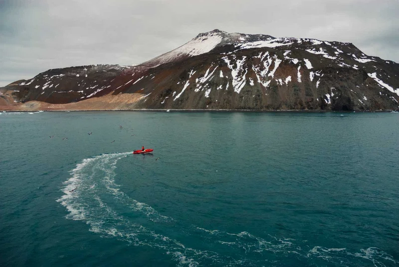
Lower Savage Islands is a grouping of low lying islands located at the mouth Frobisher Bay - the large inlet that leads to Iqaluit. The passage of time and ice, winds and water have created two channels in these islands. They almost look like they were made to be explored by Zodiac. The southern Baffin area experiences the biggest tidal fluctuations on Earth. These strong currents also keep the water in and around these islands rich and fresh. These waters provide a haven for Arctic wildlife. We hope to spot some of it during our Zodiac cruise.
Day 7: Monumental Island and Lady Franklin Island, Nunavut, Canada
The sea is pierced by two barren, isolated islands off the coast of Baffin Island. These are the Monumental and Lady Franklin Islands. They're also some of Nunavut's most biodiverse areas.
Monumental Island was named in English in honour of the ill-fated Franklin Expedition - however the Inuktitut name omianngoaq/Umiannguaq references the island's shape, translating as 'The Little Boat'. Lady Franklin Island is named after Franklin's widow, who funded seven unsuccessful expeditions to find her husband.
These islands, located far offshore and away from human settlements, are home to polar bears, walruses, and large flocks of seabirds that nest there. These are the two best places in Nunavut for viewing Arctic wildlife. Although sightings of wildlife are not guaranteed, binoculars or cameras are always handy!
Day 8: Pangnirtung, Nunavut, Canada
Pangnirtung is located in the tranquil waters of Kuugarjuaq Fjord, off Cumberland Sound. It's one of most picturesque locations in Arctic. Pangnirtung is a small Inuit town in Canada nestled among sweeping mountains capped with glaciers and miles of tundra. The place names are full of description. Kuugarjuaq means "Becoming a Large River" while Pangniqtuq is the Inuktitut word for the town and means "The Place of Bull Caribou". However, it's often called 'Pang in Canada.
In the past 100 years, the Inuit of the area have had little contact with Europeans. The settlement began as a Hudson's Bay Company Trading Post. As government services spread to the region, the town expanded. Around 1,500 residents live in the town today. It is known for both its natural beauty, which has earned it the nickname 'the Switzerland to the Arctic' and also the entrepreneurial spirit of locals. Pangnirtung has seen a growth in Inuit Art thanks to government initiatives. The town's artworks such as prints, carvings and woven products are highly sought-after worldwide, especially the Pang Hat – the iconic Nunavut headwear.
Day 9: Day at Sea, Crossing the Davis Strait Eastbound
Day 10: Sisimiut, Greenland
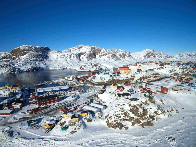
The ship arrives in Sisimiut after breakfast. Greenland’s second-largest city is home to 5,400 residents and has a lot of interesting things to see. Since 2,500 BC people have been living in Sisimiut, arriving from Arctic Canada as waves of migrants. The remains of tents, turf huts, and other remnants from that time can still be seen throughout the backcountry surrounding Sisimiut.
In 1756, Holsteinsborg was established by Count Johan Ludvig Holstein. In the oldest part of Sisimiut, you can find townhouses from that era. The oldest one dates to 1756. The Blue Church was built in Greenland in 1775 and is now one of the culturally most significant buildings. It's a prominent landmark within the historical museum district.
Sisimiut, Greenland’s biggest export, is a hub for education and industry. Local factories are responsible for processing the majority of the fish that has been caught. Fish processing plants are located in Greenland's harbour. The plant is among the biggest and most advanced in the world. KNI's headquarters are located just beyond the harbour. This government-run company re-supplies many of the small settlements in Greenland.
Sisimiut's bustling city center offers an insight into the daily lives of Greenlanders in 21st century Greenland. Here, seal hunting and smartphone use collide. Visit the Artists Workshop to purchase original artworks directly from the artists. Or, take a stroll through Spedjeso, and enjoy an exhibit at the cultural center. The expedition ship will sail to Qeqertarsuaq as the evening approaches. We'll leave Sisimiut, and head for Disko Bay with its icebergs.
Day 11: Qeqertarsuaq, Greenland
We pull in to a natural harbour that is beautifully protected, nestled beneath the 1,000-metre high mountains of Disko Island. The Danish name for the place is Godhavn, which means Good Harbour. In Greenlandic it's "Qeqertarsuaq", or "The Big Island".
Godhavn served as the capital for most of Greenland’s modern history. Godthab (now Nuuk) was responsible for South Greenland. The economic importance of Disko Bay was due to its whaling industry, which has been the dominant Arctic activity since the 16th century. Godhavn's political importance was lost when the whale-fishing industry crashed in the early 1900s. All government functions were moved to Godthab/Nuuk. The town had to reinvent itself and change its name in 1979 to Qeqertarsuaq. Qeqertarsuaq's main industries are fishing and hunting, but tourism has become increasingly important. In summer, there are daily ferry services from Disko Bay to the town, but in winter only helicopters can reach it.
The sweeping basalt hills of Qeqertarsuaq are very different from the granite-covered rolling hills that characterize most Greenland. They also provide much more fertile soil. The area is a lot greener and more lush than the rest of Greenland, despite being located well above the Arctic Circle. This rich volcanic soil combined with the mild microclimate makes it a much better place to live. In summer, locals come from Disko Bay to collect herbs, mushrooms and angelica. The stunning black sand beach and rock formations also attract tourists from around the globe. Greenlandic in nature, the town is full of colourful homes and a museum. It also has a unique church built using the Norwegian stave-style. Qeqertarsuaq is a town with a rich history and many hiking trails. It also has friendly locals. We then set off for Ilulissat, the biggest city in Disko Bay, and the Iceberg Capital of the World.
Day 12: Ilulissat, Iceberg Capital of the World
It's all here. Greenland is a popular destination for tourists from around the globe. Ilulissat, which translates from Kalaallisut as "icebergs", is known around the globe as the "Iceberg Capital of the World". No other city in the world has such an amazing natural environment.
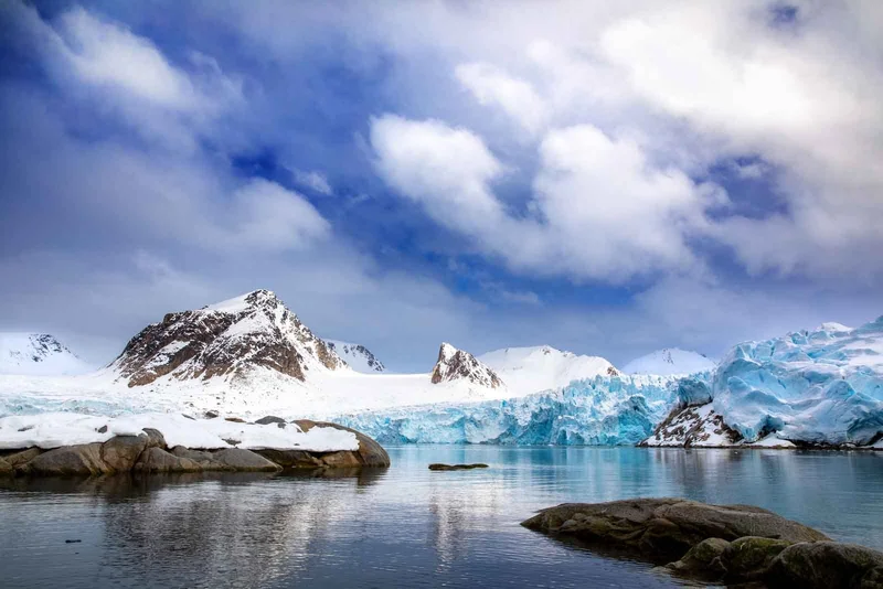
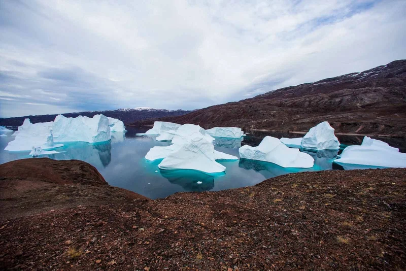
Ilulissat Icefjord is located within walking distance of the harbour. It's Greenland’s most popular site. Ilulissat Icefjord is 70km long, stretching from Disko Bay to Sermeq Kujalleq Glacier. It's choked with icebergs the size of cities. It is the largest glacier outside of Antarctica. The glacier drains 13% of Greenland Ice Sheet and produces 10% of all ice found in the Northern Hemisphere. The Ilulissat Icefjord has been designated as a UNESCO World Heritage Site because of these mind-blowing stats, combined with its indescribably stunning scenery.
Ilulissat is the third largest town in Greenland, with more than 4,500 residents. It has also become the tourism capital of Greenland, as it boasts more hotel rooms than Nuuk. Legendary Arctic Explorer, Knud Raasmussen, was born there, and the museum now occupies his childhood house. Ilulissat, Greenland’s third-largest town with over 4,500 residents, is Greenland’s tourism hub, boasting more hotel rooms that Nuuk. Visitors can enjoy the fresh seafood from local fishermen served at the cafes, restaurants and shopping. The summers are usually dry and sunny in the city. There is a wide range of hiking trails around Icefjord that can be adapted to all levels.
You will be able to take a trip on a boat with the local captain (optional excursion, fee applies). This journey lasts about 2 1/2 hours, and it is the most effective way to see the Ilulissat Icefjord. There is an option to take a fixed-wing plane flight over the Icefjord if a boat trip or hike are not enough.
The price of the tour does not include the cost of boat or flight excursions. Please refer to Price Information.
As we depart Disko Bay for Kangerlussuaq, we'll cruise in the evening southwards to see the icebergs the size of a city at the Icefjord mouth.
Day 13: Itilleq, Greenland
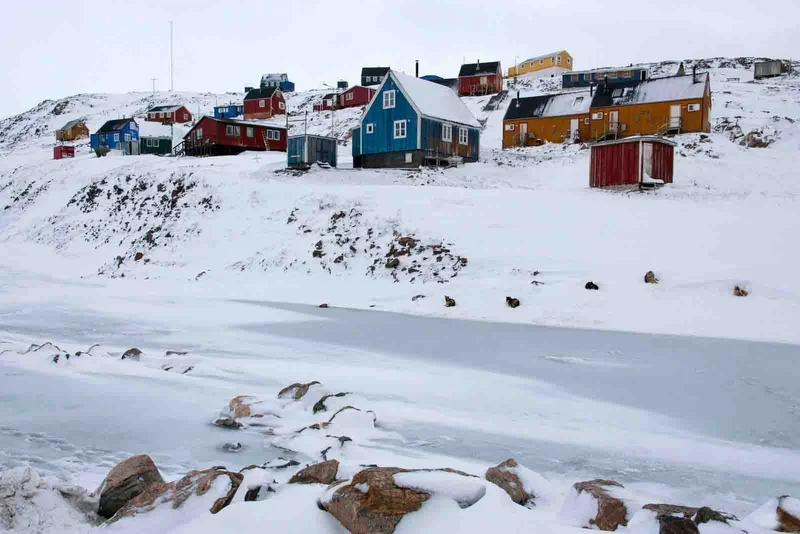
Itilleq, located just north of Greenland's Arctic Circle is a tiny village that can be found along the coastline. Itilleq is located in the Aassivisuit Nipisat UNESCO World Heritage Site. This site was included due to the ancient Inuit hunting tradition, and documents the whole habitation history in Greenland. The lifestyle has remained largely unchanged since Greenland's Inuit arrived, despite the fact that the hide tents and turf houses have been replaced with colourful modern homes. Local highways include the water, ice and sea. The sea has been feeding the Greenlanders for many thousands of years.
Itilleq's residents are still very much in touch with the world of today, thanks to their smartphones, satellite TV, and fast wifi. We hope that depending on the number of residents in town (many go on long hunting trips), it will be possible to play football with locals. We may be outnumbered, but they'll still play on their home field. Wishing you luck.
Day 14: Disembarkation, Fly Kangerlussuaq to Reykjavik/Copenhagen
We will be sailing up Kangerlussuaq Fjord, a 160 km/100 miles long fjord. We will say goodbye to the crew of the ship after breakfast on board the ship.
Kangerlussuaq is relatively isolated, compared to other Greenland regions, due to its military past and current role as a major air hub. Kangerlussuaq offers cultural activities, but the natural beauty of the area is what you'll remember most. This small airport town was built by the American Military in the 1950s and has kept some of the Cold War feel. We will board our flight back from Kangerlussuaq to Reykjavik in Iceland, or Copenhagen, Denmark, at the end of your Arctic adventure.
14 Day Artic Itinerary Includes
- Embarkation shuttle transfer to the vessel from Ushuaia city centre
- Shuttle transfer after disembarkation from the ship to Ushuaia city centre or airport
- All Zodiac landings and excursions, as per itinerary, guided by our Expedition Team
- Expedition parka
- Rubber boots loan scheme
- Briefings and lectures by our Expedition Leader and Team
- English-speaking Expedition Team
- Full board on the ship - breakfast, lunch, dinner and snacks
- Complimentary house wine, beer and soda at dinner (selected labels and brands, served at our a-la-carte dinners)
- Free tea and coffee available 24 hours
- Taxes and landing fees
- Special photo workshops
- Welcome and Farewell Cocktail Parties
14 Day Artic Itinerary Does not Include
- Extra excursions and activities not mentioned in the itinerary
- Single room supplement and stateroom upgrades
- Meals not on board the ship
- Beverages (other than coffee and tea)
- Tips for the crew (we recommend USD 14 per person per day)
- Personal expenses (e.g. Albatros Polar Spa services, Albatros Ocean Boutique purchases)
14 Day Artic Itinerary Highlights
- Explore Nuuk, Greenland's vibrant capital, where modern skyscrapers stand alongside traditional wooden houses.
- Immerse yourself in Iqaluit, the bustling capital of Nunavut, where Canadian Inuit cultures intertwine.
- Explore landmarks like the historic Hudson's Bay Company building and the iconic Arctic Cathedral.
- Embark on a thrilling Zodiac adventure to explore the Lower Savage Islands, home to diverse Arctic wildlife.
- Explore historic landmarks like the Blue Church and immerse yourself in local culture at the Artists Workshop.
Itinerary Map
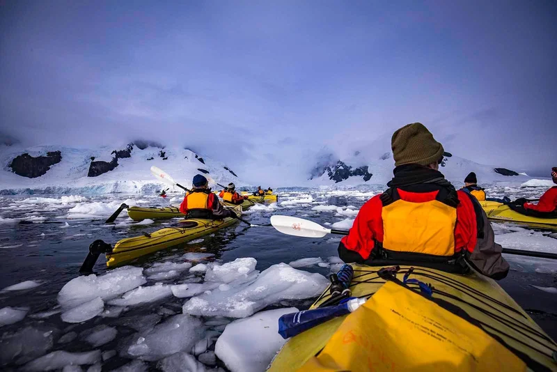
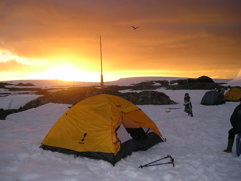
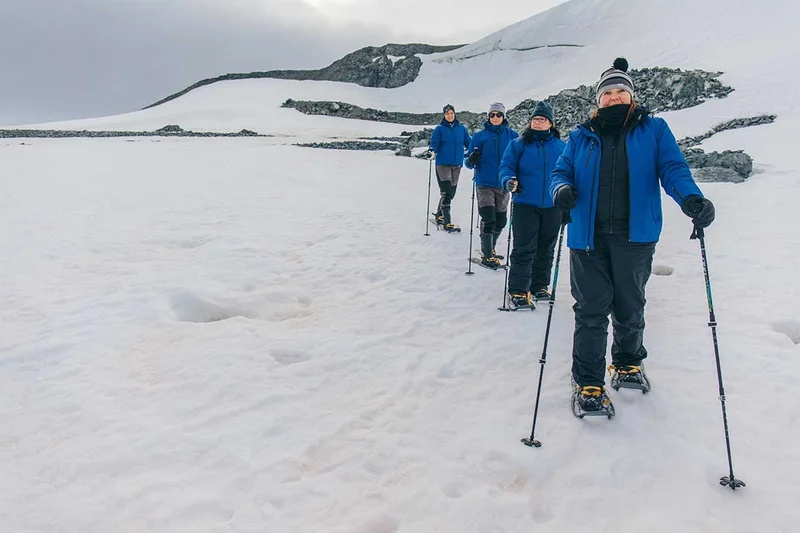
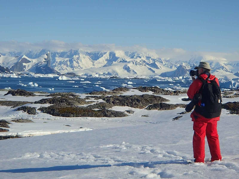
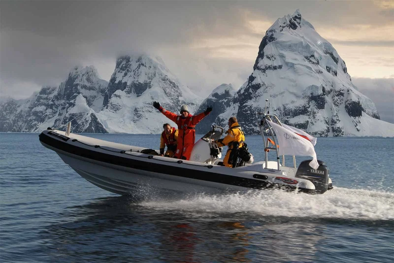
14 Day Arctic cruise activities

Animals you might see on this itinerary
Why travel with us?
Would you like to know why booking with us is the best choice?
Discover the BenefitsSimilar Itineraries
