Galapagos Islands Map
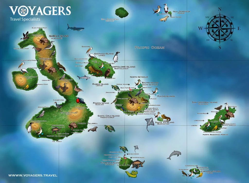
As with all voyages of discovery, a trip to the Galapagos Islands is greatly enhanced by having a little bit of knowledge about your destination before you arrive, and one way of familiarising yourself with the archipelago is to take a look at our Galapagos Islands map.

Here you’ll see all the islands laid out before you, from the substantial Isabela Island with its volcanoes, sea lion colonies, and wild tortoises, to the tiny Espanola Island with its albatross, blue-footed boobies and rocky landscape.
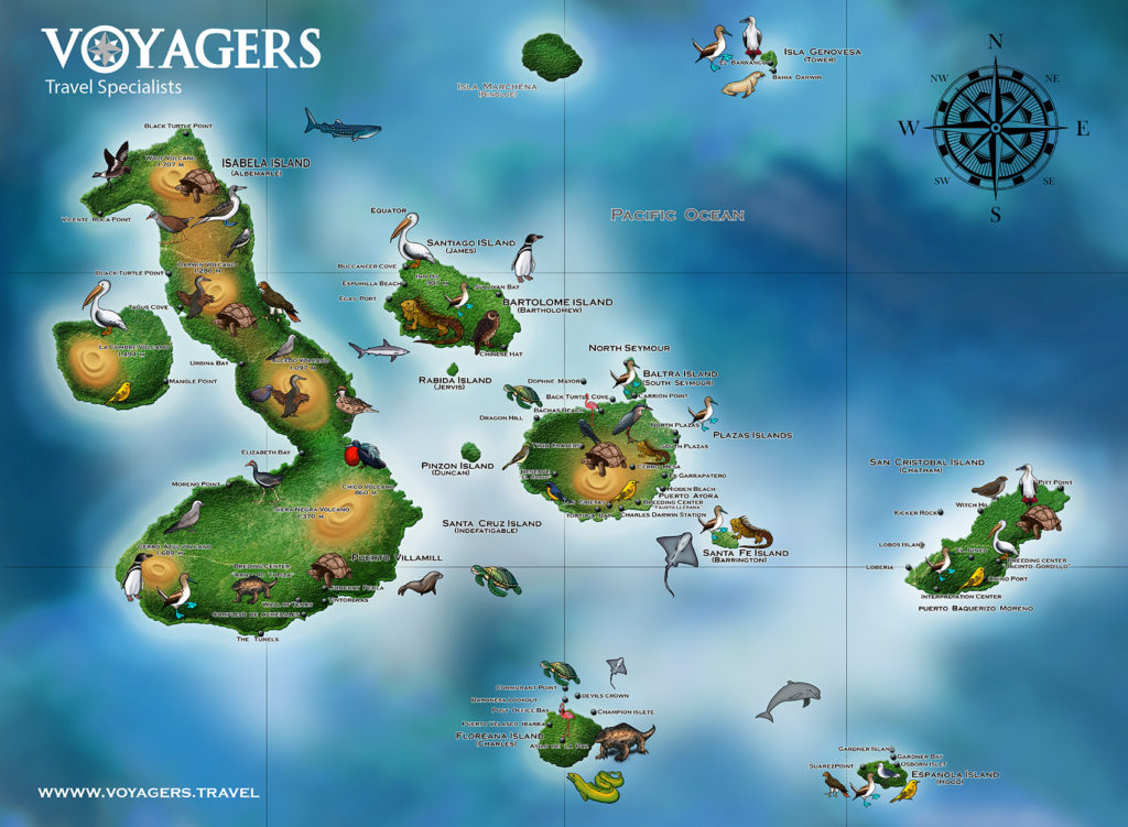
Galapagos Visitor Site Map
On this map we highlight the Galapagos National Park authorized visitor sites. These are locations that are open to visitors, one of the conditions involves being always under the supervision of a park guide. Some visitor sites are only accesible by liveaboard cruise options, while others that are closer to populated islands can be visited on a hotel based tour itinerary.Galapagos Dive Site Map
The Galapagos marine reserve is one of the most important whale shark, hammer head and other large pelagics sanctuary. The below map lists the most impotant dive sites in the archipelago. Do you want to travel to Galapagos?
We are experts finding the best rate for your Galapagos cruise or tour.
 By seeing the shape and dimensions of each island on a Galapagos Islands map, you can begin to get a feel for how the eighteen main islands relate to each other, and how every island’s location, geographical makeup and environment is completely unique.
The map should also help to give you a clearer understanding of the route that your cruise will take as you journey through the islands, visiting uninhabited outcrops, hidden coves and volcanic landscapes.
Or, if you haven’t yet chosen an itinerary, our Galapagos Islands map can help you to identify which islands or groups of islands you find the most fascinating and therefore which trips might suite your particular interests the best.
As you can see from the map, the largest of the Galapagos Islands are Isabela, San Cristobal, Santa Cruz, Santiago and Fernandina, one of the youngest islands in the archipelago, with lots of smaller islands and islets scattered across the equatorial waters.
Just looking at the Galapagos Islands map, it’s difficult to imagine the sheer variety and majesty of the life that you’ll encounter during your cruise. However, what’s for certain is that once you return, looking at the map will bring back a thousand memories of your trip to the Galapagos, the beauty of which is almost impossible to exaggerate.
Animals that you can find
0 / 0
Biggest real time availability of Galapagos cruises, over 1000 available departures in 2026, over 2000 available departures in 2027, 85 hand selected ships to choose from
Low to High


