

Chimborazo - get closer to the Sun | Travel Blog
Taita Chimborazo (meaning “dad” in Quechua), as the locals affectionately call it, is a volcano that figures on a lot of “the …est” lists. The closest point to the Sun. The highest summit on Earth, when measured from the center of the planet. The highest mountain in Ecuador and in the Andean mountain range. No wonder so many people take it as a goal to reach its 6310m high peak. Even though not technical, it is a strenuous hike and not everybody manages to get to the top. I didn’t have a chance to make the summit (yet!), but I have a lot of Ecuadorian friends who did and shared their tips and guidelines with me. I hope this article will help you achieve this goal plus it will give you some ideas of what to do in the Chimborazo area even if you’re not planning to reach the summit at this time (we can do it together one day!)
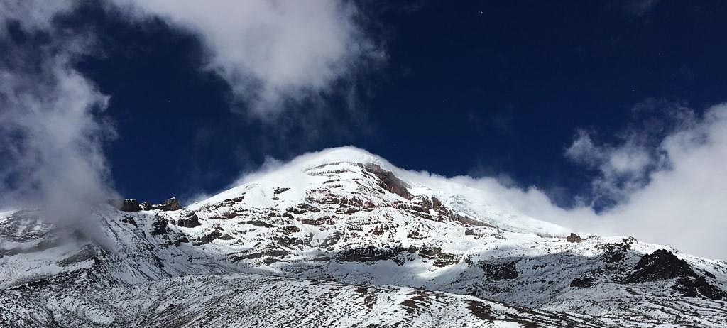
Together with the Galapagos Islands and the Amazon rainforest, Chimborazo is one of Ecuador’s most important natural wonders.
Chimborazo Fauna Protection Reserve
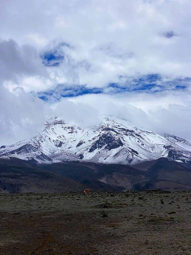
The giant volcano is an icon of the protection zone created in 1986 to take care of the unique ecosystem of the mountain and its surrounding. Even though it seems to be covered only with vast wastelands (known as El Arenal), it is home to an extensive population of llamas, alpacas, and Peruvian vicuñas brought to the country in 1988. What’s more, the glaciers covering Chimborazo’s peak are a mother to Ambato, Chimbo, and Chambo springs, being a primary water source for the three provinces below the volcano. Chimbo spring then enters the great river Guayas that goes all the way to the sea and is recognized in the Ecuadorian coat of arms as a link between the mountains and the Pacific coast. Carihuairazo is another volcano that belongs to the reserve and its 4900m peak is a popular practice climb before the Chimborazo ascent.
There are 38 different indigenous communities that live within the territory of this protected zone. Many of them are descendants of the famous hieleros of Chimborazo, which loosely translates to “ice collectors”. They would cut huge blocks of ice out of the glaciers and transport them as far as the coast. Today there is only one hielero left and you can accompany him during his workday. You can also take a hike that follows the historic route of the “ice collectors” and goes from Chimborazo to Riobamba.
The Activities
Speaking of hiking, even if you don’t feel like you’re ready to tackle Chimborazo just yet, there are plenty of other options to start with. Just remember that we are talking about high altitudes, so most of them require an assistance of a professional guide.
First, there’s the Machay Temple, a 4560 m high pyramid-shaped rock with a cave where the indigenous people used to leave offerings for their Taita Chimborazo. It starts from the Chorrera viewpoint and is 8km long with medium difficulty. Another option with similar difficulty is the aforementioned Hieleros Trail. It takes you from the Cuatro Esquinas (Four Corners) area to the Ice Mine and has an overall length of 11.6km. There’s also the Carihuairazo Volcano, but with its 4900m, that’s a whole other expedition.
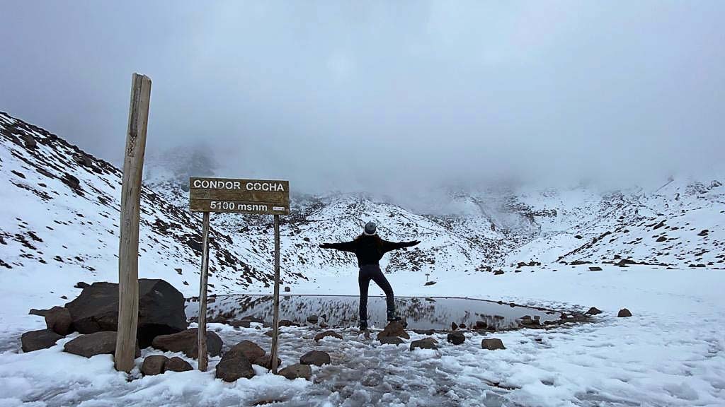
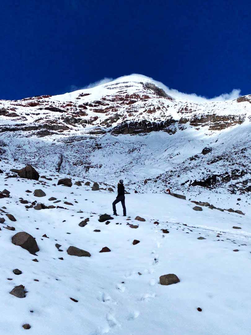
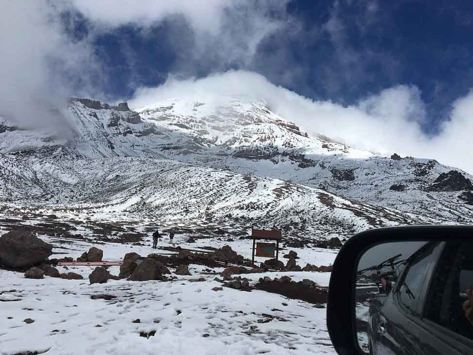
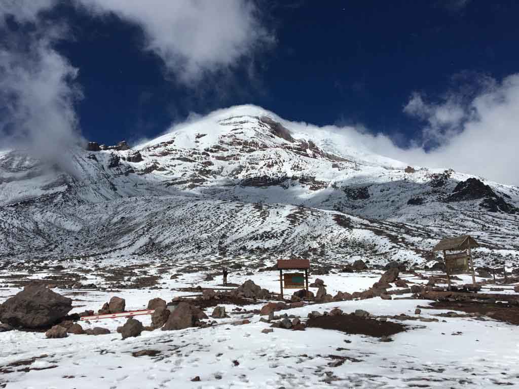
If you’re in Chimborazo just for a one-day visit you can do what I did to make the most of it. The last parking area lies at 4800m, just next to the Carrell refuge. From there you can hike another 300m up to the Condor Cocha Lagoon, passing by the second, Whymper refuge (Edward Whymper and the Carrell brothers were the first people ever to reach Chimborazo’s peak in 1880). The lake is small but beautiful and if you’re lucky to get there at a cloudless moment of the day, you’ll see the most stunning reflection of the volcano in the steady mirror-like waters.
After returning to the parking lot you can take out your bike and enjoy a thrilling ride down to the park’s entrance (4370 m). The road has quite a few turns but it’s well-maintened and leveled. The car goes a few meters in front of you making sure you’re ok and there’s no other vehicle coming so you can just focus on the ride. I felt like a condor on the attack! You can organize the bike and helmet by booking a trip in Riobamba, being the closest city, but you can easily find a trip like that leaving from Quito, Ambato, or any other bigger city. I left from Baños de Agua Santa and personally recommend making the trip with Voyagers Travel.
Voyagers travel has several Ecuador tour options that visit the entire Andes region, including visits to the Chimborazo volcano and natural park area as part of traversing the Avenue of Volcanoes. Some trips start in Quito and overland onwards to Cuenca or Guayaquil, while other itineraries do a loop visiting the Amazon and heading back towards Quito passing by Ecuador’s tallest peak. Here are a few sample itineraries for inspiration:
Another fun thing to do is go to the neighborhood town of Guano and try your strength in rock climbing. You can go straight there or, again, organize it beforehand with your tourist agency. Whether it’s hiking, cycling or climbing keep your eyes open for the local flora and fauna. Except for the herds of llamas and vicuñas you can spot deers, condors, Andean hummingbirds, and paramo wolves.
Attacking the Peak
The situation as of October 2022
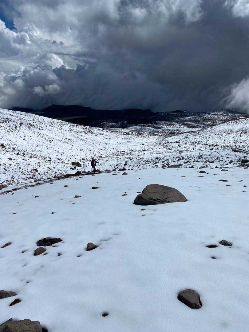
Now let’s get down to business! Climbing Chimborazo is something I definitely want to do in the future, so I performed thorough research on the subject when I was there in September 2021. I found out that due to global warming causing glaciers to melt, the situation on the mountain has been changing dramatically throughout the last years. Much of what you can find about the climb online might not be valid anymore. Landslides and rockfalls practically swept the original route away making it really dangerous to follow the line that’s been used for hundreds of years.
Both refuges have been closed for almost two years, first due to the pandemic and then because of the worsening conditions on the mountain. This year, on the 14th of April the Carrell refuge at 4800m reopened to visitors, but a new way of ascending the peak has already been established meanwhile, Before the pandemic, it was common to spend the night at one of the shelters and then ascent the 1200 - 1400m to the top during the night. Currently, the companies rather set up a high camp closer to the beginning of the new route that follows the western ridge.
The cost and do I really need to pay it?
Due to the refugees’ closure tourist companies established their high camps at the height of 5200m - 5400m. You climb there from the parking lot (4800m) during the day, rest throughout the afternoon, and then attack the peak at midnight. It cuts the distance nearly in half, so it’s easier to get to the top but it’s reflected in the price as well. While for the climb starting from the refuge you’d pay around 450$ per person (minimum 2 people) or 680$ per 1 person now you have to add another 160 - 170$ to it for climbing from the high camp.

The price includes all the professional equipment, transport to the reserve and back, food and of course a guide. It is enforced by law that there can be no more than 2 people per guide so you can usually see little groups of 3 anxiously preparing for the hike or victoriously coming back from the peak. It is impossible to do the top without a professional guide, even if you are an experienced mountain climber – You can contact one of Voyagers travel advisors for a proposal, which can be customized depending if you need acclimatization treks or if you want to go direct to the summit.
You have to know the exact route by heart and it’s not as easy and straightforward as you might imagine. The route is full of hidden crevices, places prone to landslides, spots known to have rocks falling, etc. Also, it’s simply illegal to do it without professional supervision so the rangers will likely stop you at some point.
The climb breakdown
On your first day, you will be transported to the reserve’s parking lot from the city of your choice (usually Quito, Riobamba, or Baños de Agua Santa). Then you will have to hike to the high campof your company, usually between 5200m and 5400m high. You will have to carry all your personal equipment (crampons, clothes, etc.), but the food, tents, and most of the camp gear will be taken care of by the porters. It takes around 3h to get there. Then you’ll have plenty of time in the afternoon to eat, rest, and ask your guide a million questions like: “How do I not die out there?”
You will start the actual climb at midnight that night so try to get some sleep before. It takes around 6h to get to the peak, just in time to see a magnificent sunrise that you won’t forget for the rest of your life. It’s impossible to predict the weather at such altitude so I can’t assure you you’ll see the panorama of Ecuador all the way to the coast, but… you might! Even if it’s cloudy, you’ll see the sun rising above the sea of clouds which is an unworldly and breathtaking view.
After you’re done exhaling and soaking in you’ll descend back to the high camp which takes around 2h. You will eat, rest and then hike the remnant distance to the parking lot (around 1h) where the car will be waiting to take you to your city.
The requirements
Chimborazo, unlike many other 6000m+ climbs, is not a technical route that needs tons of experience and multiple days to tackle. For the most part, it’s a very steep trek on the side of a glacier, but you need to prepare for it just as well. It’s most recommendable or better said required to have some previous experience in the high mountains. You should have considerable stamina and endurance, so it’s good to practice before this climb by doing some other hikes.
Probably the most important thing is getting used to the altitude. Going down with altitude sickness in the middle of the final stretch to the top is not something you wanna experience. I’m talking dizziness, massive headaches, vomiting, or even fainting. To avoid that spend at least a few days prior to the Chimborazo attempt at the 4500m+ altitude.
You can link those two (altitude adjustment and stamina practice) by doing other Ecuadorian mountains in the area. If you’re starting from Quito you can climb Rucu Pichincha (4785m), a volcano you can get to by a cable car straight from the city center. You can also go to the Cotopaxi National Park and hike Pasochoa Volcano (4200m) or Cotopaxi itself (5897m). If you’re starting from Baños try getting to the top of Taita Chimborazo’s “wife” - Mama Tungurahua (5010m). You can also just spend a few nights in the reserve area and do the hikes recommended before in this article. Either way, enjoy your time on The Giant!
looking into the future in which we hopefully make it to the top

Agata Szymula
Travel Writer
Credentials
- ✓ Voyagers Travel Contributor
- ✓ Master's Degree in Latin American Studies